

If you are looking for a World Map Appalachian Mountains, you are in the right place. This detailed Appalachian Mountains Map helps students, travelers, teachers, and geography enthusiasts locate one of the world’s oldest mountain ranges on a global map. Our printable maps clearly show where the Appalachian Mountains are located in North America while explaining their geographical importance, history, and physical features. You can also download the map in high-quality PDF format for educational and personal use.
World Map Appalachian Mountains
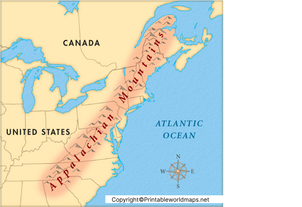
The World Map Appalachian Mountains highlights the location of the Appalachian Mountain Range along the eastern part of North America. Stretching for approximately 2,400 km (1,500 miles), the mountains extend from the Canadian province of Newfoundland and Labrador through eastern Canada and the United States to central Alabama.
The Appalachian Mountains are among the oldest mountain ranges on Earth, having formed approximately 480 million years ago during the Ordovician Period. Although millions of years of erosion have reduced their original height, they remain one of the most significant mountain systems in the world.
The mountain chain passes through the following U.S. states:
- Alabama
- Georgia
- Tennessee
- North Carolina
- South Carolina
- Virginia
- West Virginia
- Maryland
- Pennsylvania
- New Jersey
- New York
- Connecticut
- Massachusetts
- Vermont
- New Hampshire
- Maine
It also extends into eastern Canada, making it an internationally significant geographical feature.
Printable World Map Appalachian Mountains
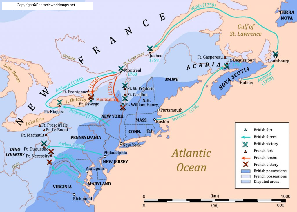
Our Printable World Map Appalachian Mountains is designed for classrooms, schools, universities, and self-learning. The printable version provides a clear visualization of the mountain range within the context of the entire world map.
The map is useful for:
- Geography assignments
- School projects
- Classroom presentations
- Competitive exam preparation
- Physical geography studies
- Travel planning
- Environmental research
The printable version is available in high resolution and can easily be printed on standard A4 or larger paper sizes.
Appalachian Mountains Map
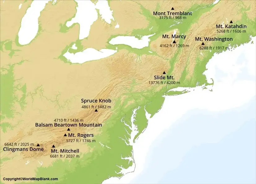
The Appalachian Mountains Map provides a detailed representation of the entire mountain system, including its three major physiographic regions:
Northern Appalachians
This region stretches through New England and eastern Canada. It contains rugged mountains, forests, and numerous glacial landforms.
Central Appalachians
Located mainly in Pennsylvania, Maryland, Virginia, and West Virginia, this section includes the Allegheny Mountains and extensive plateaus rich in coal resources.
Southern Appalachians
The southern region contains the highest peaks of the Appalachian Range, including Mount Mitchell (2,037 meters / 6,684 feet), the highest mountain in the eastern United States.
The map also identifies nearby rivers, valleys, forests, and surrounding geographical features, making it an excellent educational resource.
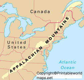
You can here get the readily usable format of the Appalachian mountains with its link to the world’s geography. We are here offering the exclusively available printable format of the map that is available for all our readers. This map is an interactive source of finding the Appalachian mountains on the world map. The map comes in the combined form of worlds and these mountains’ geography. It highlights the mountain regions on the world map so that scholars can easily visualize these mountains for their learning purpose.
Appalachian Mountains on World Map
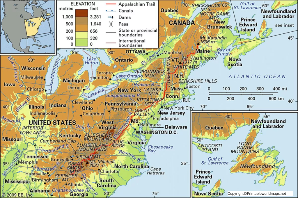
The Appalachian Mountains on World Map make it easy to understand the mountain range’s global location. Unlike regional maps, the world map shows how the Appalachian Mountains fit into North America’s overall geography.
Students can quickly identify:
- Eastern North America
- Atlantic Ocean
- Great Lakes region
- Appalachian Highlands
- Eastern United States
- Eastern Canada
Understanding their position on a world map helps learners compare the Appalachian Mountains with other famous mountain systems such as the Rocky Mountains, Andes, Alps, and Himalayas.
Interesting Facts About the Appalachian Mountains
- The Appalachian Mountains are approximately 480 million years old, making them among the oldest mountain ranges in the world.
- The range stretches nearly 2,400 km (1,500 miles).
- The highest peak is Mount Mitchell, located in North Carolina.
- The famous Appalachian Trail extends about 3,540 km (2,200 miles) from Georgia to Maine.
- The mountains are home to one of the richest temperate forest ecosystems on Earth.
- More than 25 million people live within the Appalachian Region.
- The region contains thousands of plant and animal species, many of which are found nowhere else.
- The mountains played an important role in the early settlement and economic development of North America.
Why Study the Appalachian Mountains?
Learning about the Appalachian Mountains helps students understand:
- Plate tectonics and mountain formation
- Geological history of Earth
- Natural erosion processes
- Physical geography of North America
- Biodiversity and ecosystems
- Climate and weather patterns
- Natural resources and mining regions
These topics are commonly covered in school geography curricula and competitive examinations.
Download Printable Appalachian Mountains Map
Our downloadable World Map Appalachian Mountains is available in printable formats suitable for schools, colleges, offices, and personal learning. Whether you need a labeled reference map or a printable educational resource, this map offers a simple way to explore one of the world’s most important mountain systems.
Frequently Asked Questions (FAQs)
What are the Appalachian Mountains?
The Appalachian Mountains are one of the oldest mountain ranges in the world, extending across eastern North America from Canada to Alabama in the United States.
Where are the Appalachian Mountains located on the world map?
They are located in eastern North America, stretching from Newfoundland and Labrador in Canada to central Alabama in the United States.
How old are the Appalachian Mountains?
Geologists estimate they formed around 480 million years ago.
What is the highest peak in the Appalachian Mountains?
Mount Mitchell in North Carolina is the highest peak at 2,037 meters (6,684 feet).
Why are the Appalachian Mountains important?
They are important for their geological history, biodiversity, forests, natural resources, tourism, and educational value.
Can I download a printable Appalachian Mountains map?
Yes. You can download and print the map in high-quality PDF format for educational and personal use.
