
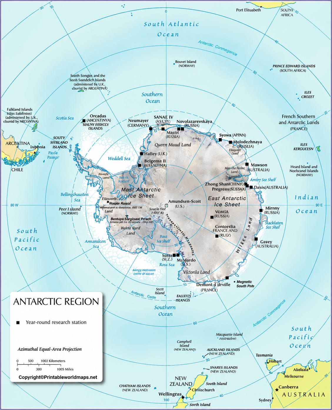

The Antarctica Physical Map helps students, teachers, geography enthusiasts, and researchers explore the physical features of the southernmost continent. Use the printable map images and PDF files below to study Antarctica’s ice sheet, mountain ranges, glaciers, coastal regions, and surrounding Southern Ocean.
Antarctica is the fifth-largest continent and is almost entirely covered by ice. Beneath its frozen surface lies a varied landscape of mountains, valleys, plains, and geological formations. This guide explains the major physical features shown on an Antarctica map and provides printable resources for learning and reference.
Antarctica Physical Map
The Antarctica physical map provides a visual reference for understanding the continent’s landforms and icy environment. Depending on the map’s labels and level of detail, readers can use it to identify mountain ranges, coastal areas, glaciers, ice shelves, and other geographical features.

Antarctica surrounds the South Pole and is encircled by the Southern Ocean. The continent’s surface is dominated by a massive ice sheet formed over thousands of years as accumulated snow becomes compressed into ice.
Important geographical features of Antarctica
- Ice sheet: Covers almost the entire continent and conceals much of the underlying landscape.
- Mountain ranges: The Transantarctic Mountains divide East Antarctica from West Antarctica in a broad geographical sense.
- Glaciers: Large bodies of moving ice transport ice from the interior toward the coast.
- Ice shelves: Floating extensions of land-based ice that project over the ocean.
- Coastal regions: Include bays, peninsulas, exposed rock, and ice-covered shorelines.
- Subglacial landscape: Mountains, valleys, and basins exist beneath the thick ice.
These features make a physical map useful for studying Antarctica’s relief, geology, and relationship with the surrounding ocean.
Printable Antarctica Physical Map
A printable Antarctica physical map can support classroom activities, geography assignments, independent study, and presentations. Before using the map for a specific assignment, check its labels and legend to confirm which features are represented.

Antarctica is not simply a flat expanse of snow. Its ice sheet rests on a complex bedrock landscape that includes mountain ranges, deep basins, valleys, and areas of exposed rock. Some geographical features are visible at the surface, while others have been identified through scientific surveys and radar measurements.
Is Antarctica completely covered by ice?
Antarctica is almost completely covered by permanent ice, but small areas of exposed rock exist along the coast, in mountain ranges, and at isolated peaks known as nunataks. The Australian Antarctic Program reports that only about 0.4% of Antarctica is not covered by ice.
The thickness of the ice varies considerably across the continent. The average thickness is approximately 2.16 kilometres, and the maximum measured thickness exceeds 4.7 kilometres, according to the Australian Antarctic Program. These measurements help explain why the continent’s underlying terrain is difficult to observe directly.
Map of Antarctica Physical
A physical map of Antarctica helps readers understand the relationship between its mountains, ice-covered interior, glaciers, and coastal areas. It is especially useful when studying how the continent’s landscape differs from that of other continents.

Major mountain ranges and landforms
Transantarctic Mountains: This extensive mountain system crosses Antarctica and separates much of East Antarctica from West Antarctica. Parts of the range rise above the surrounding ice.
Ellsworth Mountains: Located in West Antarctica, these mountains include Mount Vinson, the highest mountain on the continent.
Antarctic Peninsula: This long, narrow extension of land points toward the southern tip of South America. It contains mountain ranges, glaciers, and ice shelves.
Glaciers and ice shelves: Glaciers flow across the land toward the coast, while ice shelves float on the ocean but remain connected to land-based ice.
Subglacial valleys and basins: The bedrock beneath the ice contains major depressions and valleys that are important to geological and climate research.
A physical map may not show every subglacial feature. Use scientific bedrock maps when you need detailed information about terrain hidden beneath the ice.
Physical Map of Antarctica
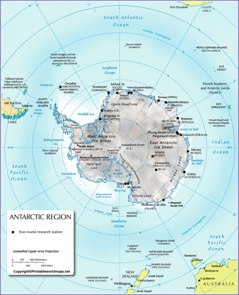
The physical map of Antarctica can be printed for school projects, geography lessons, research notes, and personal reference. For the clearest results, select a PDF version when available and check the page orientation and print scaling before printing.
How to use the printable Antarctica map
- Open one of the PNG map images or PDF resources above.
- Review the labels and map legend, if provided.
- Print the map on paper suitable for your assignment or project.
- Identify the South Pole, mountain ranges, glaciers, ice shelves, and coastal features shown.
- Add notes or labels for a geography exercise, if the map is intended for annotation.
For a digital assignment, you can also use the map as a reference while reading about Antarctic landforms and climate.
7 Amazing Facts About Antarctica’s Physical Geography
1. Antarctica is the coldest continent
Antarctica experiences extremely low temperatures, especially in its interior. The World Meteorological Organization recognizes a record low air temperature of −89.2°C, recorded at Vostok Station on 21 July 1983.
2. Antarctica is considered a desert
Despite its enormous ice sheet, Antarctica is classified as a desert because it receives very little precipitation in many areas, particularly on the high polar plateau.
3. The ice sheet hides an extensive landscape
Mountains, valleys, plains, and deep bedrock basins lie beneath the ice. Radar surveys and other geophysical techniques help scientists map this hidden terrain.
4. Mount Vinson is Antarctica’s highest mountain
Mount Vinson rises to approximately 4,892 metres above sea level in the Ellsworth Mountains. It is the highest peak on the continent.
5. Antarctica is surrounded by the Southern Ocean
The Southern Ocean encircles Antarctica and connects with the Atlantic, Indian, and Pacific ocean basins. Its currents influence marine ecosystems and global ocean circulation.
6. Glaciers transport ice toward the coast
Ice slowly moves from higher interior regions toward the ocean. Some glaciers feed ice shelves, and pieces of ice can eventually break away to form icebergs.
7. Antarctica is important for climate research
Ice cores preserve information about past atmospheric conditions. Satellite observations and field measurements also help scientists study changes in ice thickness, ice movement, and the global climate.
Why Is the Antarctica Physical Map Important?
A physical map provides a visual introduction to the continent’s landforms and natural environment. It can help learners:
- Understand the distribution of mountain ranges and ice-covered regions.
- Identify major geographical features and the surrounding ocean.
- Compare Antarctica’s terrain with other continents.
- Support school assignments, presentations, and geography lessons.
- Explore how glaciers and ice sheets shape the landscape.
A general physical map is useful for an overview, while a scientific topographic or bedrock map is more appropriate for detailed research.
Frequently Asked Questions About the Antarctica Physical Map
1. What does an Antarctica physical map show?
An Antarctica physical map shows natural geographical features such as mountain ranges, glaciers, ice sheets, ice shelves, coastal landforms, and other features included by the mapmaker.
2. Where can I download a printable Antarctica physical map?
You can use the PNG images and PDF download links provided in this article. Check each file before printing to confirm that it contains the geographical features you need.
3. Is Antarctica completely covered by ice?
No. Antarctica is almost entirely covered by ice, but small areas of exposed rock exist along parts of the coast, in mountain ranges, and at isolated peaks.
4. What is the highest mountain in Antarctica?
Mount Vinson, located in the Ellsworth Mountains, is Antarctica’s highest mountain, reaching approximately 4,892 metres above sea level.
5. Which ocean surrounds Antarctica?
The Southern Ocean surrounds Antarctica and connects with the Atlantic, Indian, and Pacific ocean basins.
6. What is the difference between a physical map and a political map of Antarctica?
A physical map emphasizes natural features such as mountains, ice sheets, glaciers, and coastal formations. A political or territorial map emphasizes territorial claims, research stations, or other human-defined information.
7. Can students use these Antarctica maps for school projects?
Yes. The maps can be used as geographical references for school projects and classroom learning. Check the file’s labels, resolution, and usage permissions before submitting or republishing it.
Reference links
https://www.antarctica.gov.au/about-antarctica/geography-and-geology/geography/
https://www.antarctica.gov.au/about-antarctica/ice-and-atmosphere/ice-sheet/
https://www.antarctica.gov.au/about-antarctica/geography-and-geology/geology/
https://www.bas.ac.uk/about/education-and-schools/antarctic-factsheet/
https://www.nasa.gov/frequently-asked-questions-about-antarctica/
