

A Labeled Arkansas Map helps you identify the state capital, major cities, county boundaries, rivers, and neighboring states. These free printable Arkansas maps are useful for students, teachers, travelers, researchers, and anyone studying the geography of the United States.
Choose the map that best suits your needs, view the labeled map online, or download the available PDF and PNG files for printing and offline reference.
Labeled Arkansas Map
Arkansas is located in the south-central United States and is commonly known as The Natural State. Its capital and largest city is Little Rock, which lies in the central part of the state along the Arkansas River.
Arkansas shares borders with six states: Missouri to the north, Tennessee and Mississippi to the east, Louisiana to the south, Texas to the southwest, and Oklahoma to the west.
The state covers approximately 53,179 square miles of total area, including land and water. According to the 2020 U.S. Census, Arkansas had a population of 3,011,524. The Census Bureau estimated its population at 3,114,791 on July 1, 2025.
Use the labeled map below to locate Arkansas and understand its principal geographic features.
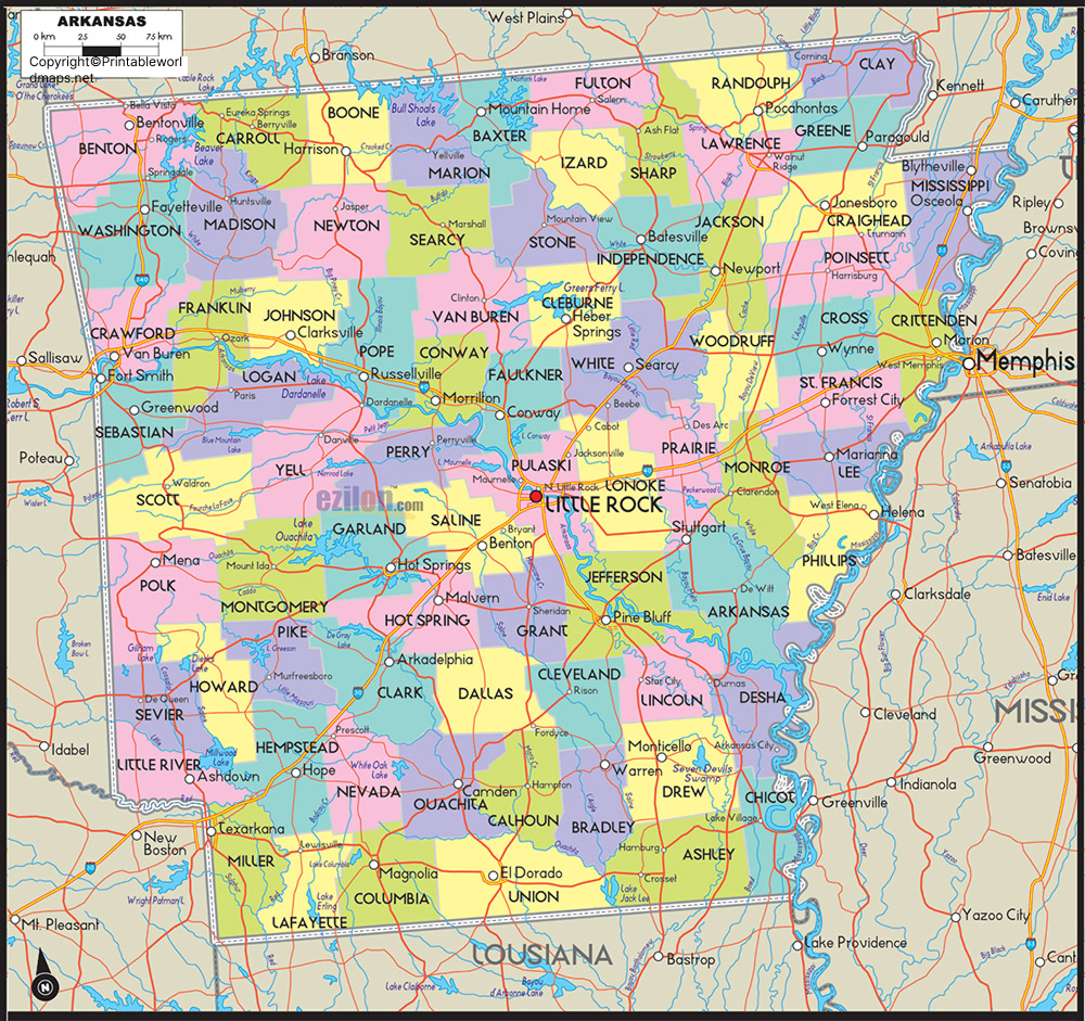
What Can You Find on a Labeled Arkansas Map?
Depending on the map version, you can use the labels and geographic features to identify:
- State capital: Little Rock, the capital of Arkansas.
- Major cities: Fayetteville, Fort Smith, Jonesboro, Springdale, Bentonville, Conway, and Hot Springs.
- Neighboring states: Missouri, Tennessee, Mississippi, Louisiana, Texas, and Oklahoma.
- Major rivers: The Arkansas River, Mississippi River, White River, Red River, and Ouachita River.
- Geographic regions: The Ozark Mountains, Ouachita Mountains, Arkansas River Valley, and Mississippi Alluvial Plain.
- Transportation features: Selected highways and other routes, when included in the map.
Map details vary by version. Check the labels and legend on the individual map before using it for a specific assignment or project.
Labeled Map of Arkansas Printable
A printable Arkansas map is convenient for classroom activities, geography homework, presentations, and personal reference. Choose the version that includes the level of detail you need.
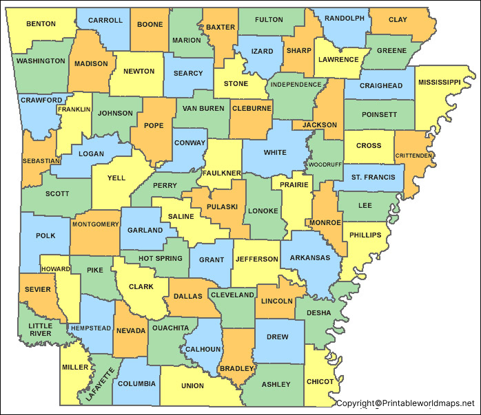
How to Print the Arkansas Map
- Open the PDF file using a PDF reader or your browser.
- Select the print option and choose your paper size, such as US Letter or A4.
- Select landscape or portrait orientation according to the map’s proportions.
- Use the fit-to-page setting to help prevent labels or state boundaries from being cut off.
- Preview the page before printing to confirm that the place names are readable.
For school assignments, use a map with clear labels. For detailed geographic research, consult an official government map or a current geographic dataset.
Labeled Map of Arkansas with Cities
A labeled map of Arkansas with cities helps readers understand where the state’s principal urban areas are located. Cities are spread across different parts of Arkansas, from the northwestern Ozarks to the central capital region and the eastern Mississippi Delta.
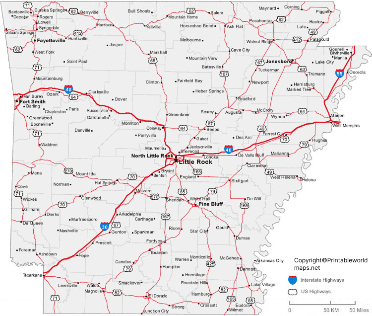
Some important cities to locate on the map include:
- Little Rock: State capital and a major population and transportation center.
- Fort Smith: A major city in western Arkansas near the Oklahoma border.
- Fayetteville: A city in northwestern Arkansas in the Ozarks region.
- Springdale: A growing city in the northwest, part of the wider Northwest Arkansas urban area.
- Bentonville: A city in northwestern Arkansas.
- Jonesboro: An important city in northeastern Arkansas.
- Conway: A city north of Little Rock in central Arkansas.
- Hot Springs: A city known for its historic thermal springs and Hot Springs National Park.
- Pine Bluff: A city in southeastern central Arkansas.
- Texarkana: A city on the Texas-Arkansas border.
The map is useful for comparing city locations, planning educational activities, and learning about the distribution of communities across the state. It is not a substitute for a current road map or navigation service.
Labeled Arkansas Map with Capital
The capital marked on a Labeled Arkansas Map is Little Rock. The city is situated in Pulaski County in central Arkansas, along the Arkansas River.
Little Rock serves as the seat of Arkansas’s state government and is an important center for commerce, transportation, education, and culture. Its central location makes it a useful reference point when studying the state’s geography.
On a capital map, look for the capital marker and its relationship to the Arkansas River and surrounding cities. If the map includes county boundaries, use them to understand Little Rock’s position within Pulaski County.
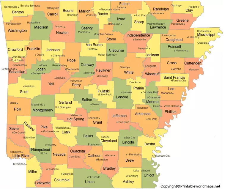
Arkansas Map with Counties
Arkansas has 75 counties, each with its own county government. A county map is helpful for understanding administrative divisions, locating county seats, and comparing areas within the state.
County boundaries are particularly useful for school assignments, regional studies, and general geographic reference. If you need to identify a specific county or county seat, choose a map that explicitly labels those features rather than relying on a city map alone.
Major Rivers and Geographic Features of Arkansas
Arkansas has an extensive network of rivers, streams, lakes, and varied landscapes. These features influence the state’s environment, recreation, transportation, and settlement patterns.
The Mississippi River forms much of Arkansas’s eastern boundary. The Arkansas River crosses the state and passes through the Little Rock area. Other important waterways include the White River, Red River, and Ouachita River.
Arkansas also contains several distinct geographic regions:
- Ozark Mountains: Located mainly in the northern and northwestern parts of the state.
- Ouachita Mountains: Found primarily in west-central Arkansas and extending into Oklahoma.
- Arkansas River Valley: A broad region associated with the Arkansas River.
- Mississippi Alluvial Plain: A low-lying region along much of eastern Arkansas.
These features help explain why Arkansas has a varied landscape, with mountains and forested uplands in some areas and flatter agricultural land in others.
For more information about Arkansas’s waterways, consult the Arkansas Department of Agriculture’s waterways resources and the Arkansas Geological Survey.
Quick Facts About Arkansas
Here are several useful facts to remember when studying an Arkansas map:
- State: Arkansas
- Postal abbreviation: AR
- Capital: Little Rock
- Nickname: The Natural State
- Number of counties: 75
- Statehood: June 15, 1836
- Bordering states: Missouri, Tennessee, Mississippi, Louisiana, Texas, and Oklahoma
- 2020 Census population: 3,011,524
- Estimated population in 2025: 3,114,791
- Land area: Approximately 51,993 square miles, based on U.S. Census Bureau data
Population figures depend on the reference year, while land area and total area are different measurements. For official statistics, use the U.S. Census Bureau’s latest published data.
Frequently Asked Questions About the Labeled Arkansas Map
What is the capital of Arkansas?
Little Rock is the capital of Arkansas. It is located in Pulaski County in the central part of the state along the Arkansas River.
How many counties are in Arkansas?
Arkansas has 75 counties. A labeled county map can help you identify their boundaries and locations.
Which states border Arkansas?
Arkansas borders Missouri, Tennessee, Mississippi, Louisiana, Texas, and Oklahoma.
Can I download a printable Arkansas map in PDF format?
Yes. The PDF links provided above include versions of the Arkansas state map, the map with cities, and the map showing the capital. Open the appropriate link to view or download the file.
What is the difference between a labeled and an unlabeled Arkansas map?
A labeled map displays place names and other geographic information directly on the map. An unlabeled map leaves names blank and is useful for quizzes, classroom exercises, and practice labeling cities, rivers, and counties.
Which city is marked as the capital on the Arkansas map?
Little Rock is the state capital. Look for its name or capital symbol on the capital map.
What is Arkansas known as?
Arkansas is commonly called The Natural State, reflecting its natural landscapes, rivers, forests, and outdoor recreation opportunities.
Which rivers should I look for on an Arkansas map?
Major rivers include the Arkansas River, Mississippi River, White River, Red River, and Ouachita River. Not every printable map includes all of them, so check the labels on your chosen version.
Reference links
https://www.census.gov/quickfacts/fact/table/AR/POP060220
https://geology.arkansas.gov/water/surface-water.html
