
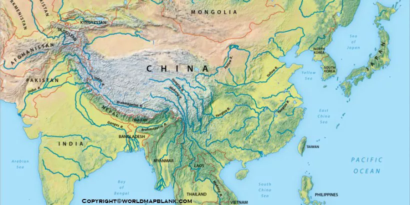

Explore our Asia Rivers Map to identify major rivers across the Asian continent. This printable map resource helps students, teachers, and geography enthusiasts understand river locations, trace river courses, and learn how rivers connect mountains, plains, cities, and seas. Use the map for geography lessons, school projects, revision, and independent study.
Download the printable map in PNG or PDF format using the links below. A labeled map can help you locate important rivers, compare river systems, and understand Asia’s diverse physical geography.
Asia Rivers Map
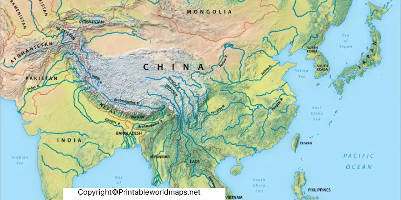
Asia is the world’s largest continent by land area and contains a wide variety of landscapes, including high mountain ranges, plateaus, plains, deserts, and coastal regions. Its river systems support agriculture, settlements, ecosystems, transportation, and electricity generation.
The Yangtze, Yellow River, Ganges, Indus, Brahmaputra, Mekong, and Amur are among Asia’s important rivers. Northern Asia also contains extensive river systems, including the Ob, Yenisei, and Lena, which flow toward the Arctic Ocean.
An Asia Rivers Map makes these river systems easier to study by showing their geographic positions and, depending on the map, their routes through different countries.
Printable Asia Rivers Map
A printable Asia rivers map is useful for classroom instruction, homework, geography quizzes, and map-labeling activities. Depending on the version, you can use it to identify river names, follow their courses, and compare the locations of rivers across East Asia, South Asia, Southeast Asia, and northern Asia.
When studying a river, look for its source, tributaries, direction of flow, and mouth. The source is where the river begins, while the mouth is where it flows into another river, a lake, a sea, or an ocean. Tributaries feed water into the main river and form a wider river system.
For the best learning experience, compare the river map with a physical map of Asia. Mountain ranges and plateaus help explain where many major rivers begin, while plains and deltas often support agriculture and dense settlements.
Map of Asia Rivers
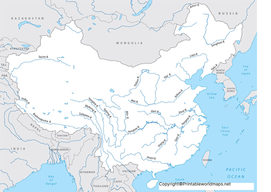
The map of Asia rivers helps readers explore the distribution of major waterways across the continent. Some rivers flow through several countries, while others lie largely within one country. Their routes reflect the region’s terrain, rainfall patterns, glaciers, and seasonal snowmelt.
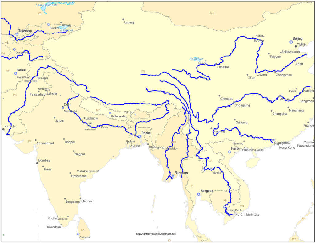
For example, the Yangtze flows across China and empties into the East China Sea. The Ganges flows through northern India and Bangladesh before reaching the Bay of Bengal. The Mekong passes through or along the borders of several countries in Southeast Asia before reaching the South China Sea.
The Indus flows through the northwestern Indian subcontinent toward the Arabian Sea. The Tigris and Euphrates drain parts of southwestern Asia and have played an important role in the region’s agricultural and historical development.
Use the map to compare these rivers’ locations and surrounding landforms. Remember that a map’s level of detail depends on its scale and labeling, so consult a detailed regional map or an authoritative geographic reference when you need precise river routes.
Map of Asia Rivers Labeled
A labeled Asia rivers map is particularly helpful for students learning the names and locations of major rivers. Use the labels to connect each river with its surrounding countries, nearby mountain ranges, and the sea or ocean into which it drains.
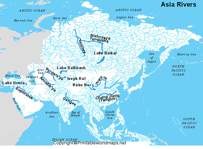
Teachers can use the printable map for classroom demonstrations, while students can use it to prepare for geography examinations and complete map-based assignments. If you are practicing for a quiz, first study the labeled version and then try identifying the same rivers on an unlabeled map.
Before printing, check the map preview to confirm that the river names and lines are readable at your chosen paper size. Select a suitable print orientation and use a larger page size when necessary to improve legibility.
Major Rivers of Asia: Names and Locations
The following examples will help you identify important rivers when using an Asia Rivers Map.
| River | Geographic location | Where it flows |
|---|---|---|
| Yangtze | China | East China Sea |
| Yellow River (Huang He) | China | Bohai Sea |
| Ganges (Ganga) | India and Bangladesh | Bay of Bengal |
| Indus | Tibetan Plateau region and the northwestern Indian subcontinent | Arabian Sea |
| Brahmaputra | China, India, and Bangladesh | Joins the Ganges river system toward the Bay of Bengal |
| Mekong | East and Southeast Asia | South China Sea |
| Tigris | Turkey and Iraq, with a course near Syria | Shatt al-Arab river system |
| Euphrates | Turkey, Syria, and Iraq | Shatt al-Arab river system |
| Lena | Siberia, Russia | Laptev Sea |
| Yenisei | Mongolia’s headwater region and Siberia, Russia | Kara Sea through the Yenisei Gulf |
River routes and national boundaries can be complex, particularly where rivers form borders or join larger river systems. Use a detailed atlas for precise border locations and tributary connections.
Interesting Facts About Asian Rivers
1. The Yangtze is Asia’s longest river. It is approximately 6,300 kilometers long and flows through China to the East China Sea.
2. The Ganges supports a major river basin. Its waters and tributaries support agriculture, settlements, ecosystems, and cultural traditions across South Asia.
3. The Mekong crosses national boundaries. Its river system connects communities and ecosystems across mainland Southeast Asia.
4. The Indus is central to South Asian geography. Its basin supports agriculture and settlements, especially in Pakistan.
5. Northern Asia has enormous river systems. The Ob, Yenisei, and Lena drain large areas of Siberia toward Arctic seas.
6. Rivers shape the land. Flowing water erodes rock, carries sediment, and deposits material that can form fertile floodplains and deltas.
7. River systems depend on their surroundings. Rainfall, snowmelt, glaciers, groundwater, dams, and water use can all affect river flow.
River lengths are approximate and can differ among reference sources because researchers may measure different headwaters or include tributaries when defining a river system.
How to Use the Printable Asia Rivers Map
- Open the map image to inspect the river names and routes.
- Download the available PDF if you want a print-friendly version.
- Locate the Yangtze, Yellow River, Ganges, Indus, Brahmaputra, and Mekong.
- Compare the rivers with the mountains, plateaus, and plains on a physical map.
- Practice naming rivers using an unlabeled map, if available.
- Check uncertain locations against a reliable atlas or geographic reference.
These activities can help learners improve map-reading skills and understand how rivers connect different physical regions.
Why Are Asian Rivers Important?
Asian rivers provide freshwater for homes, agriculture, and industry. They support fisheries, wetlands, and other habitats, while some river systems also provide routes for transportation and sources of hydroelectric power.
River valleys have supported human settlements and agriculture for thousands of years. The Indus, Ganges, Tigris, Euphrates, Yellow River, and Yangtze are associated with important historical and cultural developments.
Today, many river systems face challenges involving pollution, water demand, dams, habitat changes, and changing rainfall and snowmelt patterns. Studying river locations and drainage basins helps explain why water management often requires cooperation between regions and countries.
Frequently Asked Questions
1. What is an Asia Rivers Map?
An Asia Rivers Map shows the locations and courses of rivers across Asia. Depending on the map, it may include river names, tributaries, surrounding countries, and drainage patterns.
2. Which is the longest river in Asia?
The Yangtze River in China is generally recognized as the longest river in Asia, at approximately 6,300 kilometers.
3. What are the major rivers of Asia?
Major rivers include the Yangtze, Yellow River, Ganges, Indus, Brahmaputra, Mekong, Amur, Lena, Yenisei, Ob, Tigris, and Euphrates.
4. Can I download a printable Asia Rivers Map?
Yes. Use the PNG and PDF links provided in the relevant sections of this page. Check the downloaded file to confirm its labels and print quality before using it.
5. What is the difference between a labeled and an unlabeled river map?
A labeled map displays river names to support learning and reference. An unlabeled map is useful for practice, quizzes, and testing your ability to identify rivers independently.
6. Why are Asian rivers important?
Asian rivers supply water, support farming and ecosystems, help sustain communities, and contribute to transportation, energy production, and cultural life.
7. How can I learn Asian rivers more easily?
Start with a labeled map, group rivers by region, and compare their courses with mountain ranges and coastlines. Then practice using an unlabeled map and verify your answers with a trusted atlas.
Reference links
https://education.nationalgeographic.org/resource/asia
https://education.nationalgeographic.org/resource/understanding-rivers
https://education.nationalgeographic.org/resource/ganges-river-basin
https://www.cia.gov/the-world-factbook/about/archives/2023/field/major-rivers-by-length-in-km

2 thoughts on “Printable Asia Rivers Map | Map of Asia Rivers”