


A blank map of Quebec is a useful resource for students, teachers, geography enthusiasts, and anyone learning about Canada’s provinces and regions. This page provides printable Quebec map resources in outline, PNG, and PDF formats to support geography lessons, labeling exercises, classroom activities, and independent study.
Quebec is a province in eastern Canada, and Quebec City is its provincial capital. French is the province’s predominant language. Its vast territory includes forests, lakes, rivers, and communities spread across several geographic regions.
Use the map options below to choose a printable outline, a practice worksheet, or a transparent PNG for your learning or educational project.
Blank Map of Quebec – Outline
A blank map of Quebec outline is useful for learning the province’s shape and understanding its geographic position within Canada. An unlabelled outline gives students space to add place names, identify important rivers, mark neighboring provinces, and practice map-reading skills.

For more authoritative geographical reference material, Natural Resources Canada also provides Quebec maps with and without labels. These are useful when checking boundaries and major physical features.
Printable Map of Quebec
A printable map of Quebec can help learners study the province’s location, shape, and major geographical features. Printable maps are suitable for classroom handouts, homework, geography projects, and personal study.
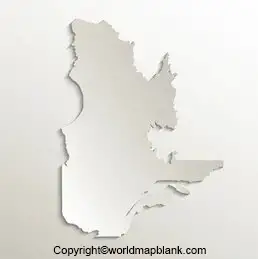
Before printing, check whether the map includes place names or shows only the provincial outline. A labelled map is useful as a reference, while an unlabelled map is better for testing geographical knowledge.
For the clearest results, select a print setting that fits the page and preserves the map’s proportions. Use a larger paper size if the map contains small labels or detailed boundaries.
Blank Map of Quebec for Practice Worksheet
A blank map of Quebec practice worksheet gives students an opportunity to test their knowledge without relying on a labelled reference. Teachers can use it for geography assignments, quizzes, group activities, and revision.
Try these activities with the worksheet:
- Identify Quebec on a map of Canada.
- Mark Quebec City, the provincial capital.
- Locate the St. Lawrence River using a reliable reference map.
- Add neighboring provinces and relevant geographic features.
- Compare your completed worksheet with an authoritative map.

For better learning results, complete the worksheet from memory first and then check your answers against a reference map.
Transparent PNG Quebec Map
A transparent PNG Quebec map can be useful for presentations, school assignments, educational graphics, and digital learning materials. Unlike an image with a solid background, a genuinely transparent PNG can be placed over a colored background without displaying an unwanted rectangular backdrop.

Transparency depends on the actual image file. Check the downloaded PNG in an image editor or design application to confirm that its background is transparent.
Use PNG when you need an image for digital layouts. Choose PDF when you want a document that is convenient to print or share.
Quebec Province and Quebec City: What’s the Difference?
Quebec is both the name of a Canadian province and part of the name of its capital, Quebec City. These are different geographic areas, so it is important to select the right map for your purpose.
- Quebec province: A large province in eastern Canada, with diverse landscapes, administrative regions, rivers, lakes, and communities.
- Quebec City: The provincial capital, located near the St. Lawrence River. A city map focuses on streets, neighborhoods, and urban landmarks rather than the entire province.
If your assignment concerns Canadian provinces, provincial boundaries, or the geography of eastern Canada, choose a map of the province. If you are studying streets or landmarks in the capital, look for a Quebec City map instead.
Important Geography Facts About Quebec
Use these facts to add context to your map activities:
- Country: Canada.
- Province: Quebec.
- Capital: Quebec City.
- Primary language: French is the predominant language.
- Major waterway: The St. Lawrence River is an important geographic feature.
- Landscape: Quebec includes extensive forests, lakes, rivers, and varied northern environments.
- Administrative geography: Quebec is divided into 17 administrative regions.
How to Print and Use a Blank Map of Quebec
Follow these simple steps to get the most from your printable map:
- Choose the outline, practice worksheet, or PNG format that suits your activity.
- Open the image or PDF and check that the entire map is visible.
- Select the appropriate paper size and use a print setting that preserves the map’s proportions.
- Label the features required for your assignment using a pencil or suitable digital annotation tool.
- Compare your answers with a reliable reference map to check geographical accuracy.
For classroom use, print an unlabelled copy for each learner and keep a labelled reference map available for checking answers.
Frequently Asked Questions About Blank Maps of Quebec
1. Where can I download a blank map of Quebec?
You can use the outline PNG and printable PDF links provided above. Natural Resources Canada also offers official reference maps of Quebec, including an outline map without names.
2. Is Quebec City the capital of Quebec?
Yes. Quebec City is the capital of the province of Quebec in Canada.
3. What is the difference between a Quebec outline map and a labelled map?
An outline map typically shows the external shape and boundaries without place names. A labelled map includes geographical names or other identifying information, making it more suitable as a reference.
4. Can I print a Quebec map for schoolwork?
Yes. A printable PDF is generally convenient for school assignments and worksheets. Check the map’s intended use and any applicable usage restrictions before redistributing it.
5. What is a transparent PNG Quebec map used for?
A transparent PNG can be layered over other images or backgrounds in presentations, worksheets, and digital designs, provided the downloaded file contains an actual transparency channel.
6. Which river is important when studying Quebec’s geography?
The St. Lawrence River is a major waterway in Quebec and an important feature to locate on a suitable reference map.
7. Where can I find official maps of Quebec?
Natural Resources Canada publishes reference maps of Quebec, and the Government of Quebec provides geographical data, administrative maps, and other cartographic resources.
Reference links
https://natural-resources.canada.ca/maps-tools-publications/maps/atlas-canada/reference-maps
https://www.quebec.ca/gouvernement/portrait-quebec/cartes-donnees-quebec
https://www.quebec.ca/gouvernement/portrait-quebec/geographie-territoire
