

A Printable Blank Map of Alabama is useful for students, teachers, homeschool activities, geography practice, presentations, and educational projects. This page provides free Alabama map resources in printable PNG and PDF formats, including blank outlines, county maps, transparent PNG maps, and practice worksheets.
Alabama is located in the southeastern United States and has 67 counties. The state covers about 52,423 square miles, making it the 30th-largest U.S. state by area. Alabama was admitted to the Union as the 22nd state on December 14, 1819.
You can use the maps below to study Alabama’s state outline, county boundaries, geography, and locations.
Alabama Blank Map Outline

Printable Blank Map of Alabama can be downloaded and printed for geography lessons, classroom activities, worksheets, and personal study.
The map can be used to identify Alabama’s state boundaries and county divisions. Alabama currently has 67 counties, according to the Alabama Department of Archives and History and the Alabama Secretary of State.
A blank outline is particularly useful when students need to label counties, cities, neighboring states, rivers, or other geographic features themselves.
Printable Map of Alabama
A Printable Blank Map of Alabama provides a simple way to study the state’s geography without pre-filled labels.

The printable map can be useful for:
- Geography homework
- Classroom worksheets
- County-labeling exercises
- Homeschool lessons
- State geography quizzes
- Student projects
- Map-reading practice
- Presentations and educational activities
For printing, PDF is generally convenient when you want a document that maintains its layout, while PNG is useful when you need an image file for digital documents or presentations.
Transparent PNG Alabama Map
A transparent PNG Alabama map can be useful when you want to place the state outline over another background, document, presentation, or educational design.

PNG stands for Portable Network Graphics, an image format commonly used for digital graphics. A transparent background can make an Alabama map easier to incorporate into presentations, worksheets, posters, and other visual materials.
For educational use, a transparent map can also be combined with labels, symbols, photographs, or other geographic information.
Alabama Map for Practice Worksheet
A blank map works particularly well as a geography practice worksheet. Students can use it to identify Alabama’s counties, cities, neighboring states, and other geographic features.
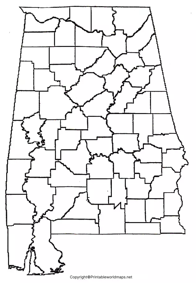
Teachers and students can turn the Printable Blank Map of Alabama into an activity by asking students to:
- Label Alabama’s neighboring states.
- Identify selected counties.
- Mark major cities.
- Locate the state capital, Montgomery.
- Identify the Gulf Coast area.
- Add rivers or other geographic features.
- Complete a map-labeling quiz.
These activities can make map-reading and geographic location practice more interactive.
Alabama Geography Facts
Here are some useful facts to accompany your Printable Blank Map of Alabama:
| Fact | Information |
|---|---|
| Region | Southeastern United States |
| Statehood | December 14, 1819 |
| Order of admission | 22nd U.S. state |
| Counties | 67 |
| Approximate area | 52,423 square miles |
| State capital | Montgomery |
| Neighboring states | Mississippi, Tennessee, Georgia, Florida |
| Southern coastline | Gulf of Mexico |
| 2020 Census population | 5,024,279 |
| 2025 population estimate | 5,193,088 |
Alabama’s official historical sources identify the state as approximately 330 miles long and 190 miles wide at its most distant points, with 52,423 square miles of area and 67 counties.
The U.S. Census Bureau estimates Alabama’s population at 5,193,088 as of July 1, 2025, compared with 5,024,279 in the 2020 Census.
Alabama’s Neighboring States
Alabama shares land borders with:
- Tennessee to the north
- Georgia to the east
- Florida to the south
- Mississippi to the west
Alabama also has a coastline along the Gulf of Mexico.
This makes a blank map particularly useful for practicing relative location and neighboring-state identification.
Why Use a Blank Alabama Map?
A blank map removes pre-filled labels so learners can actively identify geographic features. This makes it useful for both learning and assessment.
A teacher might provide an unlabeled map and ask students to locate counties, cities, state borders, or physical features. Students can also use different versions of the map for repeated practice.
For digital projects, the PNG version can be inserted into presentation slides or documents. For classroom handouts, the PDF version can be convenient for printing.
How to Use the Printable Blank Map of Alabama
You can use the maps in several simple ways:
For students: Print the map and label counties, cities, neighboring states, or physical features.
For teachers: Create quizzes, worksheets, and geography assignments using the blank outline.
For homeschool: Use the map as part of a state geography lesson.
For presentations: Use the PNG version in educational slides and digital materials.
For study: Print multiple copies and use them for repeated map-labeling practice.
Alabama Counties
Alabama has 67 counties. The Alabama Secretary of State provides a current county directory that includes all 67 counties.
The Alabama Department of Archives and History also provides historical information about the state’s counties, including their creation dates and county seats.
This makes a county-level blank Alabama map useful for learning how the state is administratively divided.
Historical Fact: Alabama Statehood
Alabama became the 22nd state of the United States on December 14, 1819. Before statehood, the area went through territorial development, including its separation from the Mississippi Territory.
This historical background can be useful when using a blank Alabama map for lessons that combine geography and U.S. history.
Tips for Printing an Alabama Map
For the clearest results:
- Choose the PDF when printing a document.
- Use the PNG version for digital projects.
- Select a suitable paper size before printing.
- Check the print preview to ensure the complete map fits on the page.
- Use a higher-quality print setting when students need to write small labels.
- Keep a clean copy for repeated classroom activities.
Frequently Asked Questions
What is a Printable Blank Map of Alabama?
A Printable Blank Map of Alabama is an unlabeled map of Alabama that can be downloaded, printed, and used for geography lessons, worksheets, quizzes, projects, and study.
How many counties are in Alabama?
Alabama has 67 counties.
When did Alabama become a state?
Alabama was admitted to the United States on December 14, 1819, becoming the 22nd state.
What states border Alabama?
Alabama borders Tennessee, Georgia, Florida, and Mississippi. It also has coastline along the Gulf of Mexico.
What is the capital of Alabama?
Montgomery is the capital of Alabama.
Can I print the Alabama blank map?
Yes. The maps provided on this page can be downloaded in image or PDF format and used for printing.
Can students use a blank Alabama map for geography practice?
Yes. A blank map can be used to practice counties, cities, neighboring states, and other geographic locations.
What is the difference between PNG and PDF?
PNG is an image format that is convenient for digital use, while PDF is commonly used for documents and printing. Both formats can be useful depending on how you plan to use the Alabama map.
What is Alabama’s population?
The 2020 Census recorded 5,024,279 residents, while the U.S. Census Bureau’s July 1, 2025 estimate was 5,193,088.
Reference Links
https://museum.alabama.gov/research/guidance/Fast-Facts.aspx
https://www.census.gov/quickfacts/fact/table/AL/HSG010225
https://www.sos.alabama.gov/city-county-lookup/counties
https://al200park.alabama.gov/path-to-statehood
https://www.revenue.alabama.gov/wp-content/uploads/2022/03/Census-2020-by-County.pdf
