
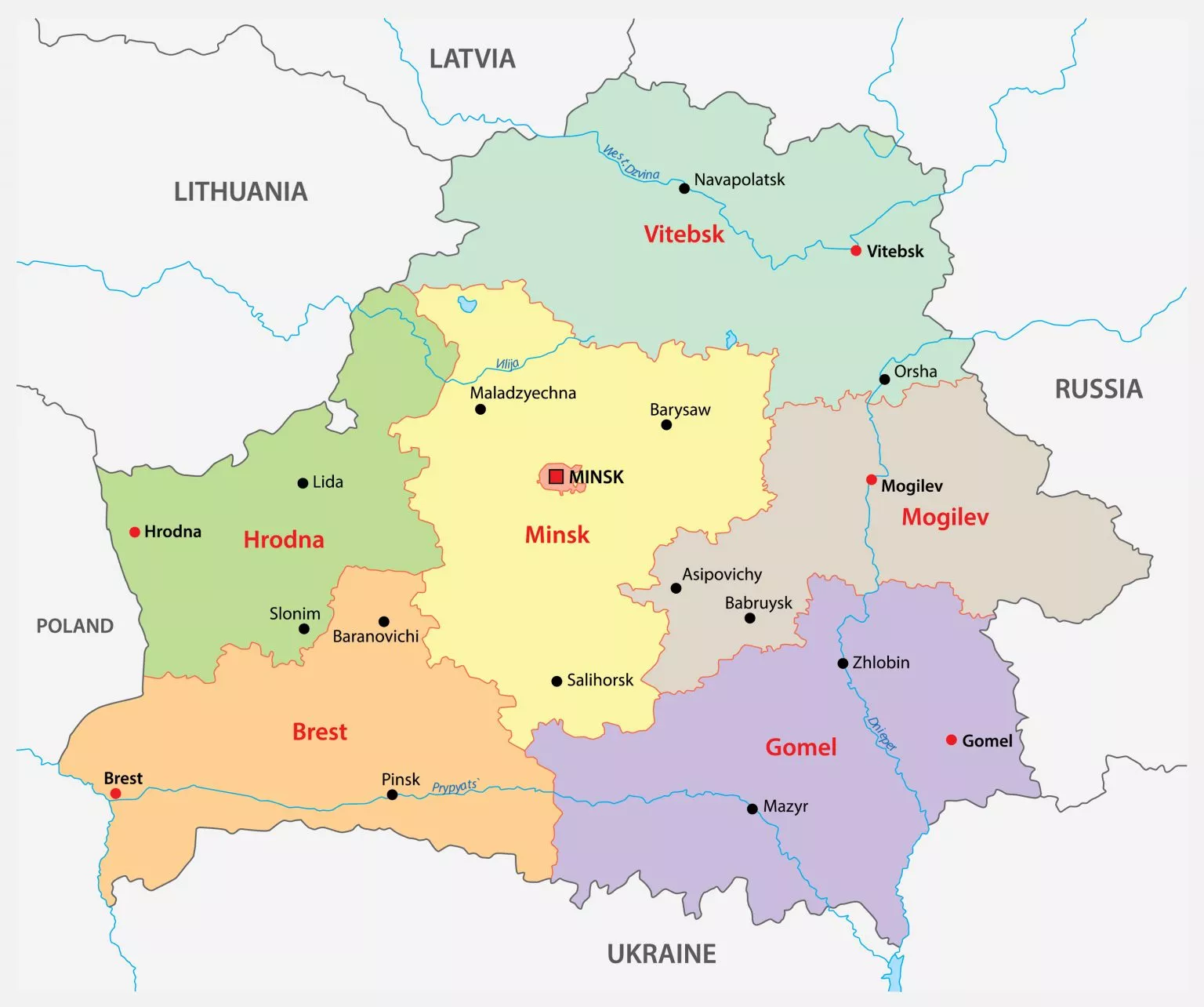
Labeled Map of Belarus is a useful way to explore the country’s regions, capital, major cities, borders, and geographic features. Belarus is a landlocked country in Eastern Europe, bordered by Russia, Ukraine, Poland, Lithuania, and Latvia.
This Labeled Map of Belarus collection includes maps showing the country’s administrative regions, major cities, and capital city Minsk. Printable PDF versions are also available for students, teachers, researchers, and anyone who needs a clear reference map.
Labeled Map of Belarus
The Labeled Map of Belarus helps identify important geographic locations throughout the country. Belarus covers approximately 207,600 square kilometres and is one of Europe’s landlocked countries.
The country shares international borders with:
- Russia to the east and northeast
- Ukraine to the south
- Poland to the west
- Lithuania to the northwest
- Latvia to the north
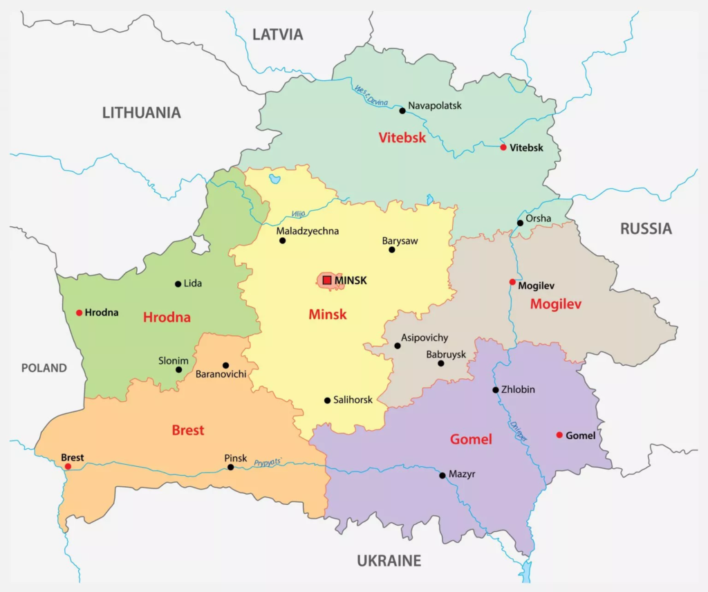
Labeled Map of Belarus with States
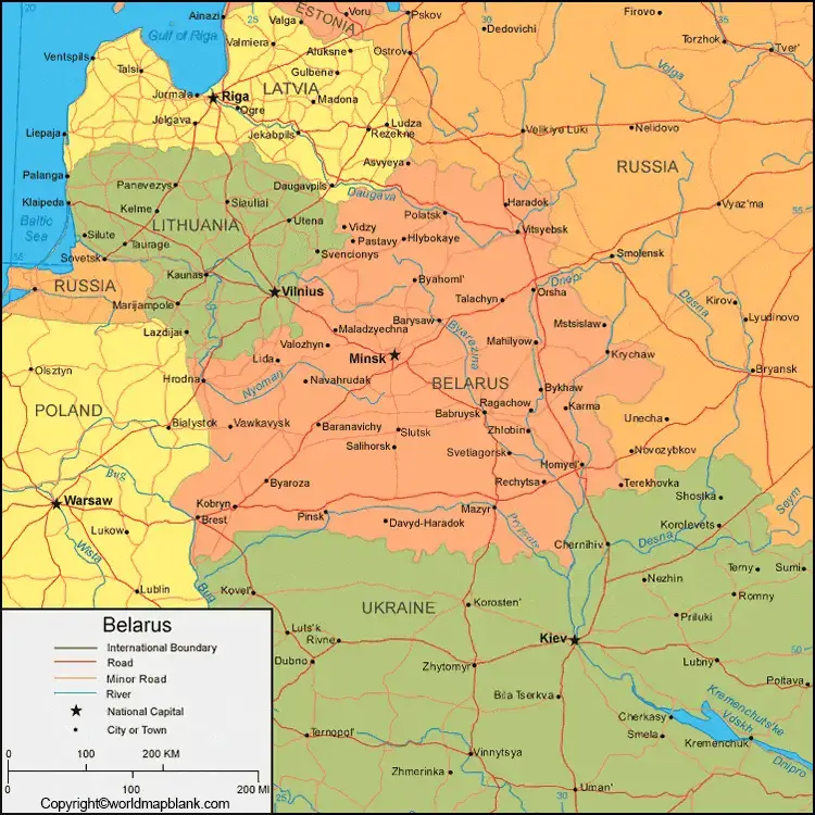
The Labeled Map of Belarus with States shows the country’s first-level administrative divisions. Belarus is divided into six oblasts (regions), while Minsk has a separate administrative status as the national capital.
The six oblasts are:
- Brest Region
- Gomel Region
- Grodno Region
- Mogilev Region
- Minsk Region
- Vitebsk Region
Minsk is not part of Minsk Region administratively; it is a separate administrative unit with the status of a city of republican subordination.
Labeled Map of Belarus with Cities
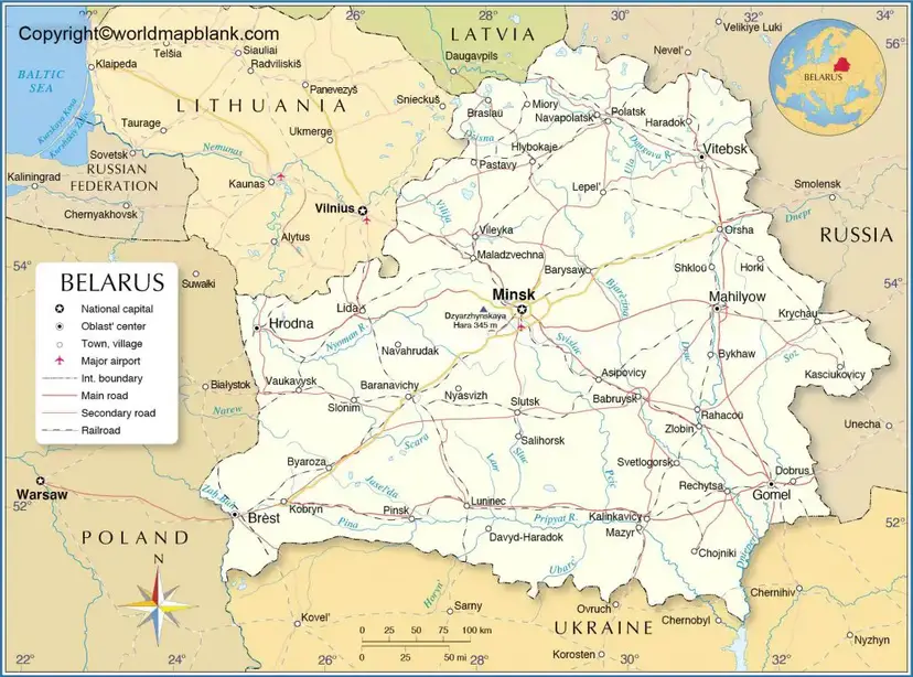
The Labeled Map of Belarus with Cities identifies important urban centres across the country. Some of the country’s major cities include Minsk, Gomel, Mogilev, Vitebsk, Grodno, and Brest.
Minsk is by far the country’s largest city and serves as Belarus’s political, administrative, cultural, and economic centre.
Other important cities have regional significance:
- Gomel — administrative centre of Gomel Region
- Mogilev — administrative centre of Mogilev Region
- Vitebsk — administrative centre of Vitebsk Region
- Grodno — administrative centre of Grodno Region
- Brest — administrative centre of Brest Region
Labeled Belarus Map with Capital
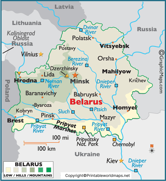
The Labeled Belarus Map with Capital identifies Minsk, the capital and largest city of Belarus. Minsk is located in the central part of the country along the Svislach River.
Minsk is an important centre for government, education, culture, transportation, manufacturing, and business. Major institutions and cultural attractions are located throughout the city.
Belarus Regions at a Glance
| Region | Administrative Centre |
|---|---|
| Brest Region | Brest |
| Gomel Region | Gomel |
| Grodno Region | Grodno |
| Mogilev Region | Mogilev |
| Minsk Region | Minsk |
| Vitebsk Region | Vitebsk |
| Capital city | Minsk |
This structure makes a Labeled Map of Belarus particularly useful when studying the country’s administrative geography.
Important Facts About Belarus
Here are several useful geographic facts to accompany the map:
- Official name: Republic of Belarus
- Capital: Minsk
- Location: Eastern Europe
- Area: Approximately 207,600 km²
- Government: Presidential republic
- Administrative divisions: Six oblasts and the city of Minsk
- Currency: Belarusian ruble (BYN)
- Official languages: Belarusian and Russian
- Highest natural point: Dzyarzhynskaya Hara, approximately 345 metres above sea level
- Major river: Dnieper
- Other important rivers: Neman, Western Dvina and Pripyat
Why Use a Labeled Map of Belarus?
A Labeled Map of Belarus can be useful for:
- Geography assignments
- School and university projects
- Classroom presentations
- Learning Belarusian regions and cities
- Identifying neighbouring countries
- Understanding administrative divisions
- Research and geographic reference
- Printable study materials
The downloadable PDF maps can also be useful when a printable reference is needed.
Belarus Map for Students and Teachers
Students can use the maps to identify Belarus’s six oblasts, capital city, major cities, rivers, and neighbouring countries. Teachers can use printable versions as classroom reference material or as supporting material for geography exercises.
For educational use, it is helpful to compare a labeled map with an outline or blank map so students can practise identifying locations independently.
Frequently Asked Questions
What is the capital of Belarus?
Minsk is the capital and largest city of Belarus.
How many regions does Belarus have?
How many regions does Belarus have?
What are the six regions of Belarus?
The six oblasts are Brest, Gomel, Grodno, Mogilev, Minsk, and Vitebsk.
Which countries border Belarus?
Belarus shares borders with Russia, Ukraine, Poland, Lithuania, and Latvia.
Is Belarus landlocked?
Yes. Belarus is a landlocked country, meaning it has no coastline on an ocean or sea.
Where is Minsk located?
Minsk is located in central Belarus, along the Svislach River.
What is the area of Belarus?
Belarus covers approximately 207,600 square kilometres.
Can I download a printable Belarus map?
Yes. Printable PDF versions of the maps are provided on this page for reference and educational use.
What are the major cities of Belarus?
Major cities include Minsk, Gomel, Mogilev, Vitebsk, Grodno, and Brest.
What does a Belarus regions map show?
A Belarus regions map shows the country’s six oblasts and the separately administered capital city of Minsk.
Reference Links
https://www.britannica.com/place/Belarus
https://www.cia.gov/the-world-factbook/countries/belarus
https://www.un.org/en/about-us/member-states/belarus
https://data.worldbank.org/country/belarus
https://printableworldmaps.net/wp-content/uploads/2023/07/Labeled-Map-of-Belarus.pdf
https://printableworldmaps.net/wp-content/uploads/2023/07/Labeled-Map-of-Belarus-with-State.pdf
https://printableworldmaps.net/wp-content/uploads/2025/05/Labeled-Map-of-Belarus-with-Capital.pdf









