
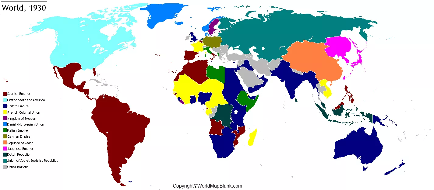

Explore the World Map 1930 to discover how political boundaries, countries, empires, and territories were represented during the early twentieth century. This collection includes printable political maps, world map images, and PDF downloads for students, teachers, researchers, and history enthusiasts.
A historical world map helps readers understand how the political geography of the world differed from today’s map. Use the maps below for educational reference, classroom activities, historical comparisons, and geography projects.
Political World Map 1930
The political world map of 1930 shows the international boundaries and territories represented in a period between the First and Second World Wars. Depending on the map’s source and publication date, it may distinguish independent countries, colonial possessions, and territories administered under international mandates.
During this period, much of Africa and parts of Asia remained under colonial rule. The British and French empires controlled extensive overseas territories, while the Soviet Union, the United States, Japan, and European states occupied important positions in global politics.

Use this map to explore historical borders and compare them with modern political maps. For accurate research, check the original map’s legend, publication date, and source because borders and territorial claims could vary between maps.
World Map 1930

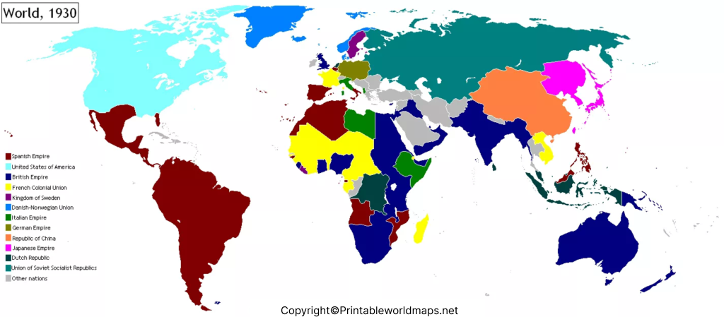
A world map from 1930 provides a useful snapshot of international geography before the major territorial changes of the Second World War. It can help readers investigate the historical locations of countries, political regions, and overseas territories.

Some important geographical and political features of this period include:
- British Empire: Britain governed territories across several continents, including areas in Africa, Asia, the Caribbean, and Oceania.
- French colonial territories: France administered territories in Africa, Asia, and other regions.
- Soviet Union: The USSR was a major state spanning much of northern Eurasia.
- Japan: Japan had an expanding regional presence in East Asia during this period.
- European political boundaries: Many European borders reflected the settlements and changes that followed the First World War.
- Mandated territories: Some former Ottoman and German territories were administered under League of Nations mandates.
These examples provide historical context rather than a complete list of every country or territory shown on the map. Always consult the map legend and a reliable historical reference when identifying individual boundaries.
Printable World Map 1930
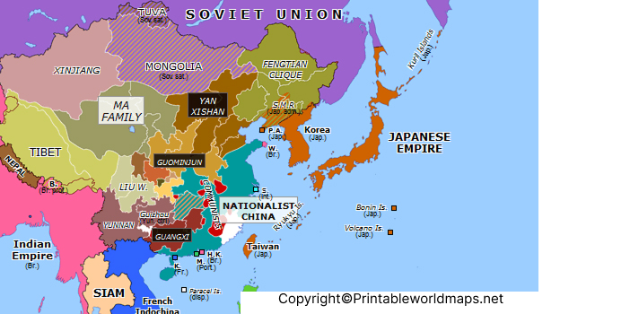
A printable world map from 1930 is useful for geography lessons, history assignments, research notes, and personal reference. You can use the image for on-screen study or download the PDF for printing.
How to use the printable map:
- Open the map image to inspect its labels, boundaries, and geographical details.
- Download the PDF version when you need a document for printing or offline reference.
- Select a paper size that preserves the map’s labels and fine boundary lines.
- Use the map legend to understand the meaning of colors, symbols, and boundary styles.
- Compare the historical map with a current political map to identify changes over time.
For the clearest print, choose a high-resolution version and use a landscape page orientation when appropriate. Check the print preview before printing, especially if the map contains small labels.
Map of World 1930
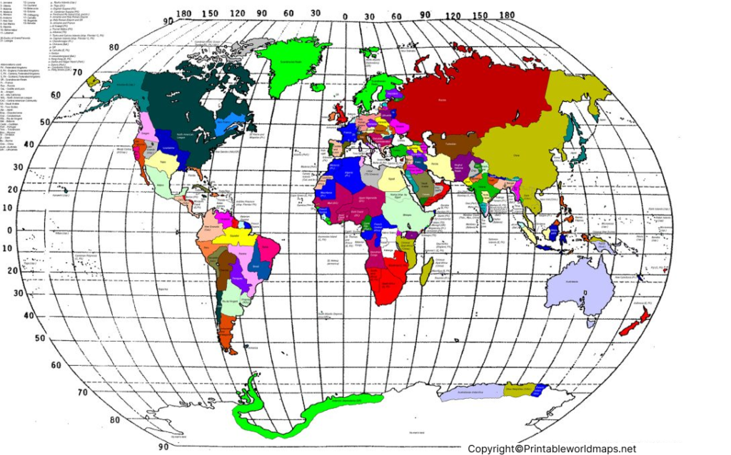
A map of the world in 1930 can help explain how geography, government, and territorial administration were connected during the interwar period. It also provides a starting point for investigating how modern national boundaries developed.
When studying a historical map, remember that a political map and a physical map serve different purposes. A political map emphasizes boundaries, states, and territories, while a physical map focuses on natural features such as mountains, rivers, plains, and elevations.
For research or academic use, check whether the map represents a specific date in 1930 or a broader period. Some historical maps were compiled from information collected earlier, so their publication year does not necessarily mean every boundary reflects conditions on a particular day.
What Changed Between 1930 and Today?
Comparing the World Map 1930 with a modern world map reveals major changes in political geography. The following examples are useful starting points for further study.
| Region or topic | Historical context |
|---|---|
| Africa | Many territories were under European colonial administration in 1930. Decolonization later led to the independence of numerous African states. |
| South Asia | British rule continued across much of the Indian subcontinent. The independence and partition of British India occurred in 1947. |
| Europe | Borders and political arrangements changed significantly during and after the Second World War. |
| East Asia | Japan’s imperial expansion and the political status of several territories shaped the region during the 1930s. |
| Middle East | Former Ottoman territories included areas governed under League of Nations mandates, alongside other political arrangements. |
| Global institutions | The League of Nations operated during this period; the United Nations was established in 1945. |
These examples describe broad historical developments and are not a substitute for checking the exact boundaries depicted on an individual map.
Why Use a Historical World Map?
Historical maps offer more than a visual record of the past. They can help readers:
- Understand changes in national borders and territorial administration.
- Study colonialism, decolonization, and the development of modern states.
- Support school assignments, presentations, and geography projects.
- Compare historical place names with their modern equivalents.
- Explore the relationship between geography and major historical events.
Teachers can ask students to identify a region on the 1930 map, locate it on a modern map, and research the political changes that occurred between the two dates.
How to Read a Political Map from 1930
Before interpreting a historical map, check its title, legend, scale, and publication information. Colors may distinguish countries from colonial territories, while different lines may indicate international borders, administrative boundaries, or disputed claims.
Place names may also differ from those used today. If a name is unfamiliar, consult a historical atlas or a reliable archival catalogue before assuming that it refers to a modern independent country.
For academic work, cite the map’s creator, title, publication date, collection, and URL where available. This helps readers verify the information and understand the map’s historical context.
Frequently Asked Questions About World Map 1930
1. What does the World Map 1930 show?
A world map from 1930 depicts the geographical and political arrangements represented by its creator. Depending on the source, it may show countries, colonial territories, international boundaries, and administered regions.
2. Where can I download a World Map 1930 PDF?
You can download the PDF versions linked in the sections above. Open the relevant map link and select the PDF download for offline viewing or printing.
3. Can I print the World Map 1930?
Yes. You can print the available image or PDF. A high-resolution PDF is generally preferable when the map contains fine lines or small labels.
4. How was the political world different in 1930?
Many regions that are independent countries today were then governed as colonies, dependencies, or mandated territories. The political map also predates the territorial changes caused by the Second World War and subsequent decolonization.
5. Was the world map exactly the same throughout 1930?
Not necessarily. Territorial changes, competing claims, administrative arrangements, and differences in map publication dates can affect how boundaries are represented. Check the source and date of the specific map.
6. What is the difference between a political map and a physical map?
A political map emphasizes countries, borders, and administrative divisions. A physical map emphasizes natural geographical features, such as mountains, rivers, and elevation.
7. Who can use a printable historical world map?
Students, teachers, researchers, history enthusiasts, and anyone interested in historical geography can use these maps for educational reference, subject to the applicable copyright and reuse terms.
8. How can I compare the World Map 1930 with today’s map?
Place the historical and modern maps side by side. Compare country names, boundaries, colonial territories, and regional divisions, then consult historical sources to understand why the differences occurred.
Reference links
https://jesusiniesta.es/maps/historic-borders/1930
https://www.nature.com/articles/125852d0
