

Labeled Map of Oregon helps readers identify the state’s capital, major cities, counties, rivers, highways, geographic boundaries, and other important locations. Oregon is in the Pacific Northwest of the United States and borders Washington, Idaho, Nevada, California, and the Pacific Ocean.
This page provides several Oregon map formats, including a labeled Oregon map, printable labeled map, Oregon map with cities, and Oregon map with its capital. These maps can be useful for students, teachers, travelers, researchers, and anyone studying the geography of Oregon.
Labeled Map of Oregon
A Labeled Map of Oregon shows the state’s major geographic and administrative features. Oregon has 36 counties, and its northern boundary is largely formed by the Columbia River, while the Snake River forms part of its eastern boundary with Idaho. Its southern boundary with California and Nevada follows the 42nd parallel.
Oregon is bordered by Washington to the north, Idaho to the east, Nevada and California to the south, and the Pacific Ocean to the west. The state contains a wide range of landscapes, including the Pacific coast, Coast Range, Willamette Valley, Cascade Range, Blue Mountains, high desert, and the Columbia River Plateau.
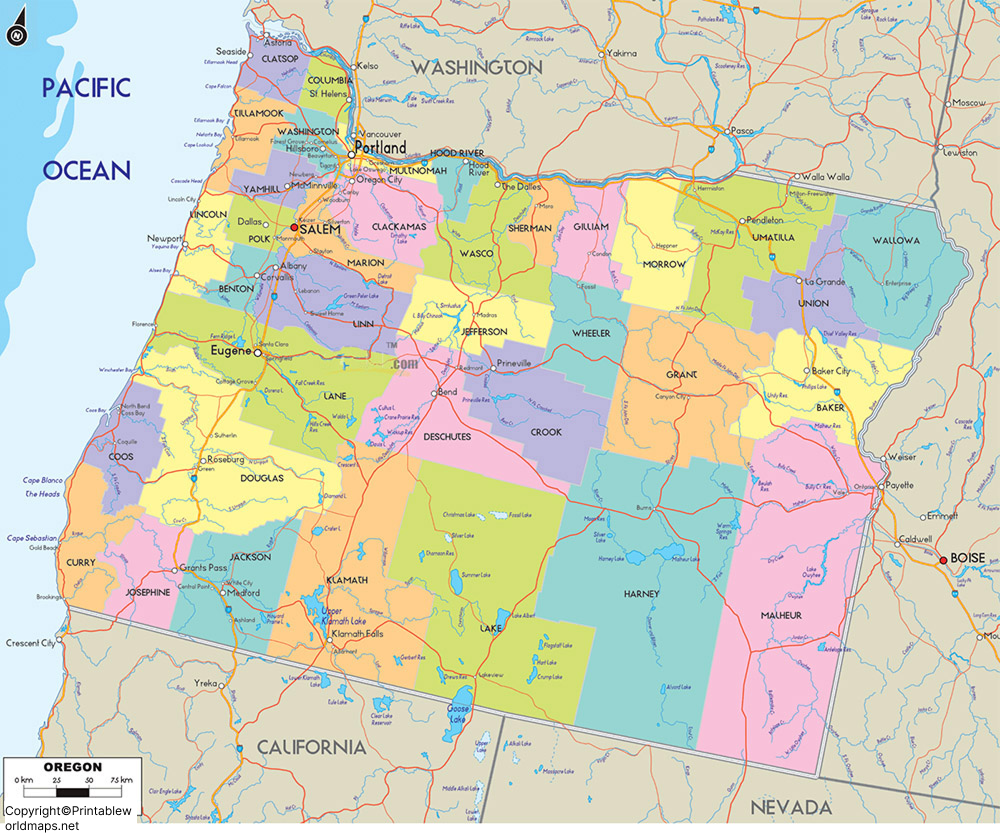
Oregon’s population was 4,237,256 in the 2020 U.S. Census, while the Oregon Secretary of State’s Blue Book reports a population of 4,296,646 in 2023. Population figures can change over time, so current estimates should be checked against the latest Census or state data.
The state is known for its diverse geography. Important rivers associated with Oregon include the Columbia River, Snake River, John Day River, Deschutes River, and Klamath River. The Columbia and Snake rivers also play important roles in defining portions of Oregon’s borders.
Printable Map of Oregon Labeled
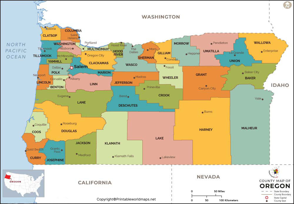
A Printable Map of Oregon Labeled is useful for classroom assignments, geography projects, trip planning, and quick reference. A labeled map can make it easier to locate cities, counties, rivers, major roads, and other geographic features.
Labeled Map of Oregon with Cities

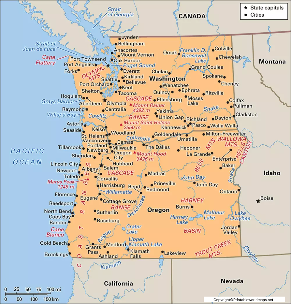
The Labeled Map of Oregon with Cities identifies major population centers throughout the state. Portland is Oregon’s largest city, followed by Salem and Eugene based on recent population estimates. The Oregon Secretary of State’s 2024 population figures list Portland at 639,448, Salem at 177,567, and Eugene at 177,155.
The U.S. Census Bureau’s latest available city estimates also provide updated population figures for many Oregon communities. For example, its July 1, 2025 estimates list Salem at 181,779, Eugene at 178,618, Gresham at 111,513, Hillsboro at 111,126, Bend at 107,342, Beaverton at 97,842, and Medford at 86,494.
Major Oregon cities include:
- Portland
- Salem
- Eugene
- Gresham
- Hillsboro
- Bend
- Beaverton
- Medford
- Corvallis
- Springfield
- Albany
- Tigard
- Lake Oswego
- Grants Pass
- Oregon City
Labeled Oregon Map with Capital
The Labeled Oregon Map with Capital highlights Salem, the capital of Oregon. Salem is also the county seat of Marion County and is located in the Willamette Valley along the Willamette River. The Oregon Secretary of State identifies Salem as Oregon’s state capital and second-largest city.
Salem is located approximately 47 miles south of Portland and 64 miles north of Eugene, according to the Oregon Blue Book. The city serves as an important center for state government, agriculture, food processing, and surrounding communities.
Oregon Counties on a Labeled Map
Oregon has 36 counties. A county map is useful for understanding the state’s administrative divisions and locating cities and communities within each county.
Some of Oregon’s largest counties by area include Harney, Malheur, and Lake, while Multnomah County is among the smallest by land area.
A county-labeled map can be particularly useful for:
- Geography students
- County research
- Travel planning
- Local government reference
- School projects
- Regional studies
- Printable classroom activities
Major Geographic Features Shown on an Oregon Map
A detailed Oregon map can help identify several important geographic regions and natural features.
Columbia River
The Columbia River forms much of Oregon’s northern boundary with Washington and is one of the state’s most significant waterways.
Snake River
The Snake River forms part of Oregon’s eastern boundary with Idaho. It is one of the major rivers associated with Oregon’s geography.
Willamette Valley
The Willamette Valley is a major geographic and agricultural region of western Oregon. Salem, Portland, Eugene, and numerous other communities are located within or closely associated with the valley.
Cascade Range
The Cascade Range crosses Oregon from north to south and includes Mount Hood, Oregon’s highest point. The Oregon Blue Book lists Mount Hood at 11,239 feet.
Pacific Coast
Oregon has a Pacific Ocean coastline along its western side, with coastal communities including Astoria, Newport, Florence, Coos Bay, and Brookings.
Oregon Map for Students and Teachers
A labeled Oregon map can be used as an educational resource for identifying:
- Oregon’s state capital
- Major cities
- 36 counties
- Neighboring states
- Pacific Ocean
- Major rivers
- Mountain ranges
- Geographic regions
- Highways and transportation routes
For classroom use, a printable map can be paired with a blank Oregon map so students can practice locating cities, counties, rivers, and geographic regions.
Interesting Facts About Oregon
- Oregon has 36 counties.
- Salem is the state capital.
- Portland is Oregon’s largest city by population.
- Oregon’s state animal is the American beaver, which was designated the state animal in 1969.
- Mount Hood is Oregon’s highest point at 11,239 feet.
- Oregon’s major rivers include the Columbia, Snake, John Day, and Deschutes rivers.
- Oregon’s 2020 Census population was 4,237,256.
- The state has 241 incorporated cities, according to the Oregon Secretary of State’s Almanac.
Frequently Asked Questions About the Labeled Map of Oregon
What is the capital of Oregon?
Salem is the capital of Oregon. It is located in the Willamette Valley and serves as the center of Oregon’s state government.
How many counties are in Oregon?
Oregon has 36 counties.
What is the largest city in Oregon?
Portland is Oregon’s largest city by population. The Oregon Secretary of State’s 2024 figures list Portland’s population at 639,448.
What are the major cities shown on an Oregon map?
Major cities commonly shown on Oregon maps include Portland, Salem, Eugene, Gresham, Hillsboro, Bend, Beaverton, Medford, Corvallis, and Springfield. Current population estimates can be checked through the U.S. Census Bureau.
Which states border Oregon?
Oregon borders Washington, Idaho, Nevada, and California. The Pacific Ocean lies along its western boundary.
What rivers form part of Oregon’s boundaries?
The Columbia River forms much of Oregon’s northern boundary, while the Snake River forms part of its eastern boundary with Idaho.
Can I print the labeled Oregon map?
Yes. A printable version can be provided in PDF format for educational, reference, and personal use.
What is Oregon known for geographically?
Oregon is known for its Pacific coastline, Willamette Valley, Cascade Range, Columbia River Plateau, mountains, forests, rivers, and high-desert landscapes.
Reference Links
https://www.census.gov/quickfacts/fact/table/OR
https://www.oregon.gov/pages/counties.aspx
https://sos.oregon.gov/blue-book/government/Pages/capital.aspx
https://sos.oregon.gov/blue-book/explore/Pages/almanac.aspx
https://sos.oregon.gov/blue-book/government/Pages/local.aspx
