


An undistorted world map helps readers understand how the sizes and shapes of continents and countries appear when Earth’s curved surface is represented on a flat page. A proportionally accurate world map, especially an equal-area projection, is useful for comparing the relative sizes of landmasses without the area distortion associated with the Mercator projection.
In this guide, you can explore printable world map images, download PDF versions, compare map projections, and learn how to choose a map for geography lessons, classroom activities, research, or personal reference.
Undistorted World Map
An undistorted world map aims to reduce a particular type of distortion, but no flat map can preserve every property of Earth’s surface perfectly. Different projections prioritize different characteristics, including area, shape, distance, and direction.
For example, the Mercator projection preserves local angles and is useful for certain navigation purposes, but it exaggerates the apparent sizes of regions at high latitudes. An equal-area projection, on the other hand, preserves the relative areas of landmasses while changing some shapes.
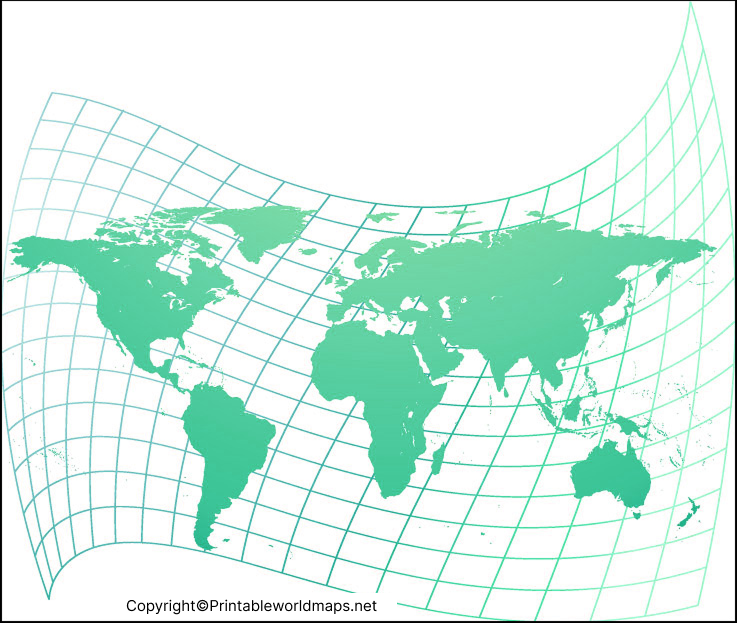
These printable resources can help students and geography enthusiasts examine how the arrangement and apparent size of continents vary across different map designs.

Proportionally Accurate World Map
A proportionally accurate world map is particularly useful when the goal is to compare the relative areas of continents and countries. Equal-area projections are designed to preserve area relationships, making them suitable for studying land distribution, population patterns, and other geographical data.
One important example is the Equal Earth projection, developed in 2018. It was designed to represent the relative sizes of Earth’s regions accurately while maintaining an appealing overall appearance for world maps.
However, an equal-area map does not preserve every feature perfectly. Shapes and directions may be distorted, and the amount of distortion varies by location and projection.
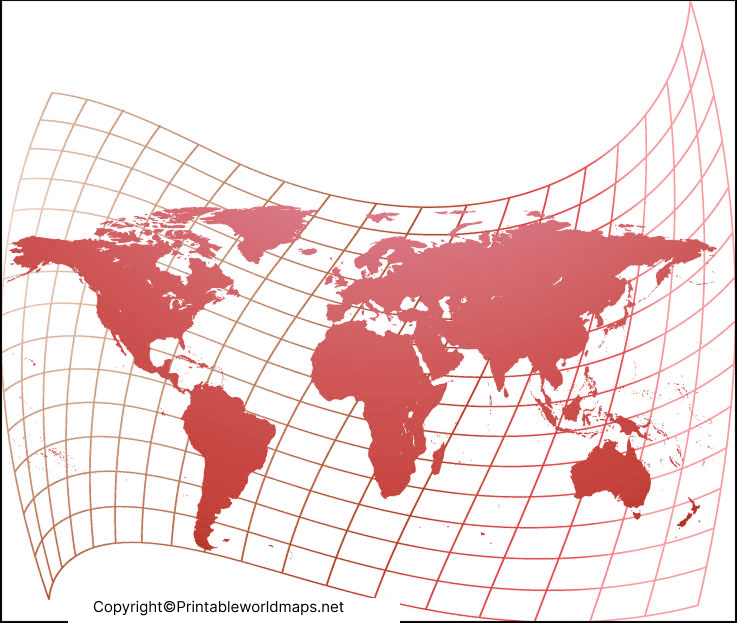
When comparing world maps, check the projection name or the map’s accompanying information. A map should not be described as completely distortion-free simply because it looks more balanced than a Mercator map.
Printable Map of World Undistorted
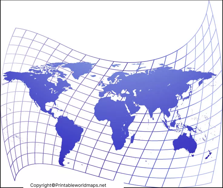
A printable map of the world is a convenient resource for classroom lessons, homework, presentations, and geography revision. Choose a PNG image if you want to view the map quickly or insert it into a document. Choose a PDF when you want a convenient format for printing, subject to the file’s page size and resolution.
How to Print a World Map Clearly
- Open the PNG or PDF file using a browser or PDF reader.
- Check the page orientation and paper size before printing.
- Select landscape orientation if it better suits the map’s layout.
- Use the print preview to ensure the map fits within the printable area.
- Choose a suitable print quality so that country outlines and labels remain readable.
If the map contains no country labels, use it for labelling exercises, identifying continents, or marking oceans and geographical regions. Always check the original image before printing to confirm that it includes the details you need.
Why Does the Mercator World Map Look Distorted?
The Mercator projection is a cylindrical map projection introduced by Gerardus Mercator in 1569. It is valuable for navigation because it represents constant compass bearings as straight lines. However, its scale increases with latitude, causing areas near the poles to appear much larger than their true relative areas.
This means Greenland can look comparable in size to Africa on a Mercator world map, even though Africa’s actual area is approximately fourteen times that of Greenland.
The difference is caused by the projection rather than by any difference in the underlying geographical data.
Five Important Facts About World Map Accuracy
1. No Flat World Map Is Perfect
Earth has a curved surface. Transforming it into a flat image inevitably changes one or more geographical properties, such as area, shape, distance, or direction.
2. Equal-Area Maps Preserve Relative Areas
An equal-area projection preserves the relative areas of geographical features. This makes it helpful for comparing countries and continents, although their shapes may look different from their appearance on a globe.
3. The Mercator Projection Has a Specific Purpose
The Mercator projection is useful for certain navigation applications. Its size distortion does not make it universally incorrect; it means the projection is less suitable for comparing the areas of regions across the world.
4. Map Choice Depends on the Task
Use an equal-area map to compare land areas, a suitable conformal projection when local shape is important, and an appropriate equidistant projection when specific distance measurements are required. For the most intuitive view of the entire Earth’s surface, a globe is often preferable.
5. The Projection Should Be Identified
When a map is used in education, research, or a presentation, identify its projection whenever possible. This helps readers understand what the map represents accurately and which limitations they should consider.
How to Choose the Right World Map Projection
| Map purpose | Suitable choice |
|---|---|
| Comparing country and continent areas | Equal-area projection |
| Certain marine navigation applications | Mercator projection |
| General educational world maps | A suitable compromise projection, such as Winkel Tripel |
| Understanding Earth’s overall shape | A globe |
| Measuring specific distances | A projection designed for the relevant distance requirements |
No single projection is best for every situation. The right choice depends on what the map needs to communicate.
Educational Uses of an Undistorted World Map
An undistorted world map can support a variety of learning activities:
- Geography lessons: Identify continents, oceans, countries, and major regions.
- Area comparisons: Explore how equal-area projections represent relative land sizes.
- Map projection exercises: Compare the same locations on Mercator, Equal Earth, and other projections.
- Classroom worksheets: Print an outline map for labelling and revision.
- Presentations and projects: Use a suitable world map to explain geographical patterns.
Teachers and students should verify the map’s projection, labels, source, and date where relevant, particularly when using maps for formal research or statistical comparisons.
Frequently Asked Questions About Undistorted World Maps
Is there a completely undistorted world map?
No. Every flat world map introduces some distortion because Earth’s curved surface cannot be represented on a plane while preserving every geographical property. A globe avoids this particular flattening problem.
Which world map shows the true relative size of countries?
An equal-area projection, such as Equal Earth or Mollweide, preserves the relative areas of geographical regions. However, it does not preserve every shape, distance, or direction.
Why does Greenland look so large on a Mercator map?
The Mercator projection increases scale toward the poles. Greenland is located at high northern latitudes, so its apparent area is greatly enlarged compared with its true area relative to lower-latitude regions.
Is an Equal Earth map the same as a Mercator map?
No. Equal Earth is an equal-area projection designed to preserve relative areas. Mercator is a conformal projection that preserves local angles but substantially exaggerates area toward the poles.
Can I print an undistorted world map for school?
Yes. You can download one of the PNG or PDF resources linked above. Check the image’s labels, resolution, and page layout before printing.
What is the difference between a PNG map and a PDF map?
A PNG is an image file that is convenient for viewing and inserting into documents. A PDF is a document format that is often more convenient for printing, although final print quality depends on the file’s resolution and layout.
Which world map projection is best for education?
The best projection depends on the lesson. Equal-area maps are useful for comparing land sizes, Mercator maps can demonstrate navigation-related properties, and compromise projections can be suitable for general world-map displays.
Where can I learn more about map projections?
The U.S. Geological Survey and National Geographic provide educational explanations of projections, their properties, and their appropriate uses. See the reference links below.
Reference links
https://www.usgs.gov/faqs/how-are-different-map-projections-used
https://education.nationalgeographic.org/resource/investigating-map-projections
https://education.nationalgeographic.org/resource/selecting-map-projection
https://proj.org/en/stable/operations/projections/eqearth.html
https://open.lib.umn.edu/worldgeography/chapter/1-1-geography-basics
